The Story of Culture and Arts
- Image resource of Korean history
- Documents from History TextBooks
- Culture & Art Stories from Korean History
- Culture & Art Stories from Korean History - Korean
- National Institute of Korean History
- History net
- About the site
- Introduce
-
Numerous topics related to Korean culture and art are mentioned in middle and high school national history textbooks, but most of them are briefly described by era, making it difficult to understand their concepts, transition processes, and characteristics.
<Culture & Art Stories from Korean History> produces and provides video materials based on expert commentary on the flow, change process, characteristics and characteristics of each major topic in the field of culture and art in Korean history.

Scenario
The Cape of Good Hope, the southernmost tip of Africa, was discovered by a Portuguese explorer in 1488. It was an historical watershed that opened the sea route from Europe to India.
However, did you know that a map that marked the Cape of Good Hope existed in Joseon Korea, 86 years prior to discovery by Dias?
This is a world map created in 1402 during the rule of Joseon’s King Taejong. From its title, 'Integrated Map' means the areas that have formed a complete whole as the world, and 'Historical Capitals' mean the capitals in the past.
The Integrated Map of Historical Capitals is recognized as the first world map that marked Southeast Asia, Europe, Africa, and West Asia in addition to Korea, Japan, and China.
According to the postscript, this map was newly edited and referenced one map of the Joseon Dynasty, one map of Japan, and two maps imported from China. We can surmise from the detailed information available on West Asia, Europe, and North Africa that maps based on Islamic maps were used as references.
“You can know the world without leaving your home, and knowing the distance between regions from the map will help you rule this kingdom.”
Mapmaking was a national undertaking that was led by high-ranking officials. What message was the Joseon Dynasty trying to convey through its detailed and precise maps?
The Joseon Dynasty drawn to a relatively larger scale!
A view of the world showing detailed information on not just East Asia but also West Asia, Europe and North Africa! Through its world map, the Joseon Dynasty proclaimed to the world that a new era named Joseon had begun.
Science and technology, Communication
10 films-
 Korean Typewriter04:37
 -
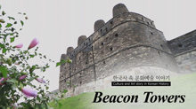 Beacon Towers09:30
 -
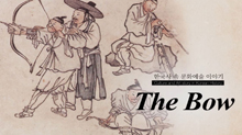 The Bow08:36
 -
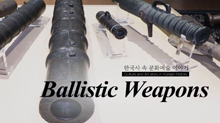 Ballistic Weapons09:06
 -
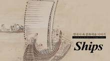 Ships in Traditional Korea09:04
 -
 Papermaking and Printing Techniques09:03
 -
 Astronomical Instruments and Calendars During King Sejong’s Reign08:50
 -
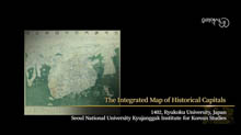 Honil Gangni Yeokdae Gukdo Ji Do02:18
 -
 Daedongyeojido04:07
 -
 Old Maps in Korea08:24